
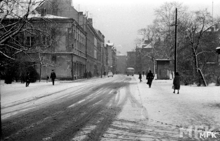
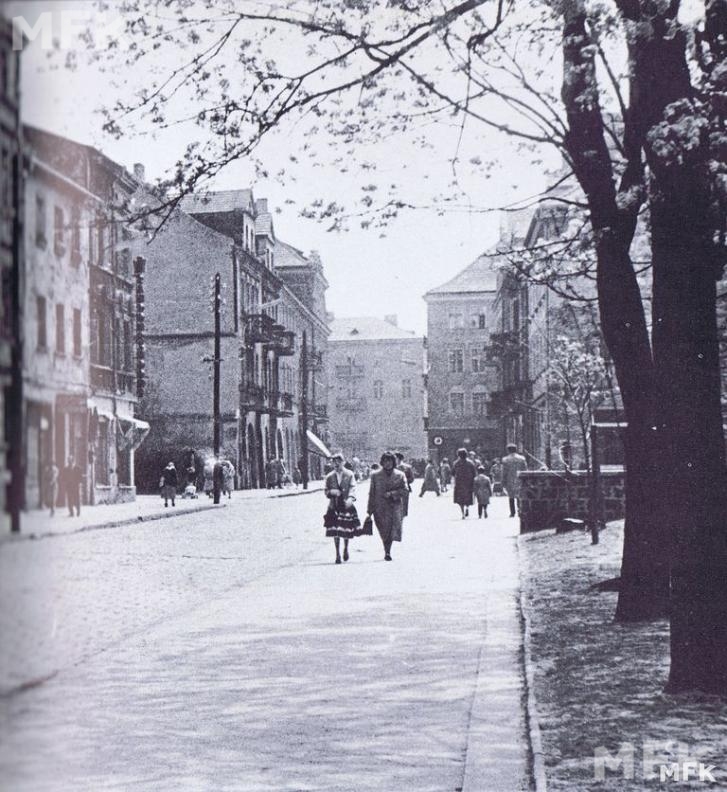
Historia Ulicy Złotej.
Wyprowadzona została w drugiej połowie XIII w. z północno-zachodniego narożnika Głównego Rynku i początkowo biegła do muru obronnego. W późniejszym czasie kilkakrotnie ją przedłużano i obecnie prowadzi do granicy miasta, skąd skręca w prawo i dochodzi do Wału Bernardyńskiego. Liczy około 2600 m długości.
Początkowo nazywała się Żydowską, bowiem stanowiła centralną ulicę dzielnicy żydowskiej, ale pod koniec XVII w. lub na początku XVIII w. jej nazwę zmieniono na Złotą.
Po rozebraniu na początku XIX w. muru obronnego, połączono ją w 1820 r. z wytyczoną wówczas ul. Ponad Murem (dzisiejsza A. Parczewskiego), biegnącą wzdłuż nieistniejących już wtedy obwarowań miejskich i płynącej obok odnogi Prosny zwanej Babinką (zasypanej w latach 1941-1949, w której miejscu obecnie znajdują się kaliskie planty). Natomiast w 1875 r., po zbudowaniu drewnianego mostu na Babince, przedłużono ją do ul. Babina, znajdującej się po drugiej stronie rzeki i połączono z dochodzącą do niej ul. Nową. W 1934 r. ul. Nowa włączona została w ul. Złotą, a powstałej w ten sposób nowej ulicy, biegnącej aż do granicy obszaru miejskiego, nadano nazwę Polskiej Organizacji Wojskowej (POW), którą w 1947 r. zmieniono na Ignacego Daszyńskiego, a trzy lata później – w 1950 r. – na Feliksa Dzierżyńskiego. W 1963 r., po powiększeniu terytorium miasta, ulica ta doprowadzona został do Kanału Bernardyńskiego i otrzymała swój obecny przebieg i aktualną długość. W 1990 r. nadano jej po raz drugi nazwę Złotej.
W 1906 r. – 21 maja – na skrzyżowaniu ul. Złotej z ul. Ciasną miał miejsce zamach bombowy na pułkownika barona Kellera, dowódcę stacjonującego w Kaliszu 15 Aleksandryjskiego Pułku Dragonów, dokonany przez członków organizacji bojowej Polskiej Partii Socjalistycznej. Pułkownik został wówczas ranny i opuścił miasto.
Na początku I wojny światowej znaczna część ul. Złotej (na odcinku od Głównego Rynku do ul. Babina) została zniszczona prawie całkowicie.
W drugiej połowie XX w. przy tej ulicy powstały zakłady przemysłowe – Fabryka Firanek i Koronek „Haft” oraz Zakład Przemysłu Dziewiarskiego „Polo”, a pod koniec tego wieku zbudowano Wyższe Seminarium Diecezji Kaliskiej.

In the second half of the 13th century the street ran from the north-west corner of Główny Rynek [Main Market Square] to the town walls. It was extended several times over centuries. Now it leads to the boundaries of the town where it turns right and reaches Wał Bernardyński [the Bernardyński Canal Embankment]. The street is 2600 metres long.
At first it was called Żydowska, as it made the central part of the Jewish. At the end of the 17th century, or at the beginning of the following century the name was changed into Złota.
At the beginning of the 19th century the town walls were dismantled and the street was joined to Ponad Murem Street [Beyond the Wall Street], now A. Parczewski Street. Ponad Murem Street ran along the used-to-be town walls as well along the arm of the Prosna River called Babinka. The watercourse Babinka was buried in the years 1941-1949 and a green area called Planty was formed on the place where the old river used to flow.
In 1875 Złota Street was extended to Babina Street situated on the other side of the river after building a wooden bridge over the Babinka Canal. Nowa Street, another street reaching the river from the opposite side was also joined to Złota Street.
In 1934 Nowa Street was included into Złota Street and the new street leading to the boundary of the town area was given the name after the Polska Organizacja Wojskowa (POW) [the Polish Military Organisation]. In the following years the street changed its name; in 1947 it was named Daszyński Street, three years later, in 1950 the name was changed into Feliks Dzierżyński Street. In 1963, after the extension of the urban territory, the street reached the Kanał Bernardyński [the Bernardyński Canal]. Since that year the street has the present run and length. In 1990, for the second time, the street was given the name Złota.
In 1906, a bomb attack was conducted on Colonel Baron Keller at the junction of Złota and Ciasna Streets. Keller, the commander of the 15 Alexandrian Regiment of Dragoons stationing in Kalisz, was injured and left the town. The attack was organised by the members of the Organizacja Bojowa Polskiej Partii Socjalistycznej [the Fighting Organisation of the Polish Socialist Party].
At the beginning of the Great War a big section of Złota Street between Rynek Główny [Main Market Street] and Babina Street was nearly completely destroyed.
In the second half of the 20th century some factories were built in Złota Street, namely Fabryka Firanek i Koronek “Haft”[the Curtains and Laces Factory “Embroidery”] and the Zakład Przemysłu Dziewiarskiego “Polo”[the Knitting Factory “Polo”] At the end of the 20th century the Wyższe Seminarium Diecezji Kaliskiej. [the Higher Seminary of the Kalisz Diocese] was built in this street.


Zdjęcia ze strony Wirtualnego Muzeum Fotografii Kalisza www.wmf.kalisz.pl